The airport map
Airport[]
When you have your coach travel throughout the country, the best way to go a long distance is by flying. To do this, as in real life, you must use the airports.
Getting to the Airport[]
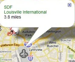
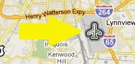
To get to the airport, you must first go to the map. This is done by clicking on the tracel button on your coaches homepage You will notice that on the bottom of the map there are two icons. Click the one with an airplane in a circle (and it looks like this ![]() ). When you click this, you the map will move and center itself on the closest airport to your current location. At this point, click the airplane icon on the map and it will bring up a pop-up on the map.
). When you click this, you the map will move and center itself on the closest airport to your current location. At this point, click the airplane icon on the map and it will bring up a pop-up on the map.
Popup Box On Map
Place Icon on the Map
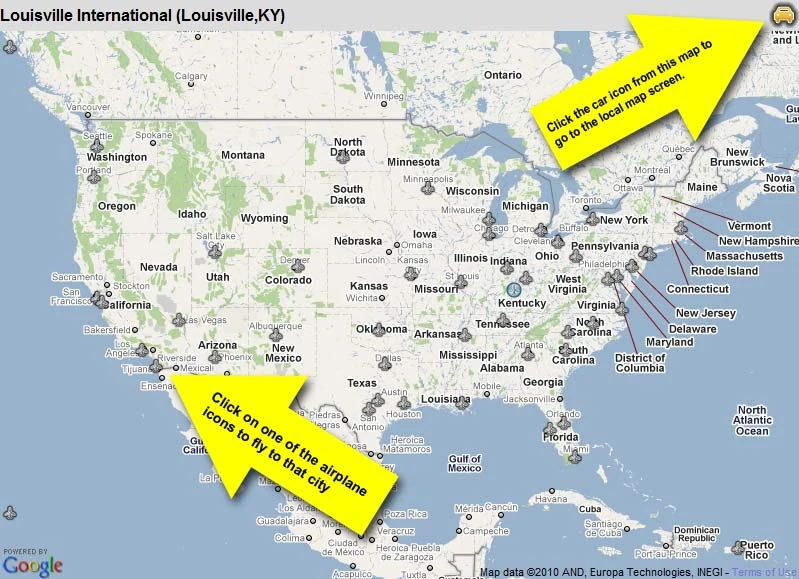
Flying Around the Country[]
When you have brought up the popup from the airplane icon on the map, you will see a link with the airport call name and the full name with the distance from you current location underneath. If you want to fly from that airport, click the name of the airport. Now, you will be taken to a map of the entire country with a bunch of airplane icons on it (they look like this ![]() ). To go to your desired city, simply click on the airplane icon in the city you want to travel to and click the link in the popup box. This is very similar to flying from the close map. Just be sure not to make a mistake in traveling because it can be costly to fly around a lot. You can tell where you are because the airport you are currently in will be highlighted (just like this
). To go to your desired city, simply click on the airplane icon in the city you want to travel to and click the link in the popup box. This is very similar to flying from the close map. Just be sure not to make a mistake in traveling because it can be costly to fly around a lot. You can tell where you are because the airport you are currently in will be highlighted (just like this ![]() ).
).
Leaving the Airport[]
When you are in your destination city's airport, you will still be in the large map and your current airport is highlighted. To go back to your "car" and be in the small scale map, click on the car icon in the upper right of the map (like this ![]() ). Be aware that you will be charged money and hours when you go to and from an airport, as well as when you fly.
). Be aware that you will be charged money and hours when you go to and from an airport, as well as when you fly.